


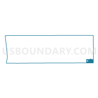
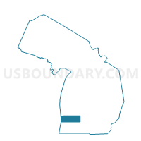
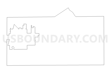
Voting District 0053572000002, Allegan County, Michigan
About
Outline

Summary
| Unique Area Identifier | 595805 |
| Name | Voting District 0053572000002 |
| County | Allegan County |
| State | Michigan |
| Area (square miles) | 16.43 |
| Land Area (square miles) | 16.13 |
| Water Area (square miles) | 0.30 |
| % of Land Area | 98.16 |
| % of Water Area | 1.84 |
| Latitude of the Internal Point | 42.45642630 |
| Longtitude of the Internal Point | -85.58833660 |
Maps

Graphs
Select a template below for downloading or customizing gragh for Voting District 0053572000002, Allegan County, Michigan


Neighbors
Neighoring Voting District (by Name) Neighboring Voting District on the Map
- Voting District 0053572000001, Allegan County, MI
- Voting District 0056164000002, Allegan County, MI
- Voting District 0056474000001, Allegan County, MI
- Voting District 0156626000002, Barry County, MI
- Voting District 0770084000001, Kalamazoo County, MI
- Voting District 0771798000001, Kalamazoo County, MI
- Voting District 0771798000002, Kalamazoo County, MI
- Voting District 0771798000004, Kalamazoo County, MI
Top 10 Neighboring County Subdivision (by Population) Neighboring County Subdivision on the Map
- Cooper charter township, Kalamazoo County, MI (10,111)
- Gun Plain township, Allegan County, MI (5,895)
- Otsego township, Allegan County, MI (5,594)
- Plainwell city, Allegan County, MI (3,804)
- Alamo township, Kalamazoo County, MI (3,762)
- Prairieville township, Barry County, MI (3,404)
Top 10 Neighboring Place (by Population) Neighboring Place on the Map
Top 10 Neighboring Unified School District (by Population) Neighboring Unified School District on the Map
- Gull Lake Community Schools, MI (18,888)
- Plainwell Community Schools, MI (15,313)
- Otsego Public Schools, MI (13,922)
- Delton-Kellogg School District, MI (11,783)
Top 10 Neighboring State Legislative District Lower Chamber (by Population) Neighboring State Legislative District Lower Chamber on the Map
- State House District 61, MI (103,705)
- State House District 88, MI (99,795)
- State House District 87, MI (96,428)
- State House District 60, MI (93,096)
- State House District 80, MI (87,871)
Top 10 Neighboring State Legislative District Upper Chamber (by Population) Neighboring State Legislative District Upper Chamber on the Map
Top 10 Neighboring 111th Congressional District (by Population) Neighboring 111th Congressional District on the Map
Top 10 Neighboring Census Tract (by Population) Neighboring Census Tract on the Map
- Census Tract 28.02, Kalamazoo County, MI (5,847)
- Census Tract 320, Allegan County, MI (5,260)
- Census Tract 319, Allegan County, MI (5,007)
- Census Tract 321, Allegan County, MI (4,496)
- Census Tract 28.01, Kalamazoo County, MI (4,264)
- Census Tract 29.01, Kalamazoo County, MI (3,762)
- Census Tract 105, Barry County, MI (3,404)